How to Reach Tawang from Guwahati via Tezpur, Bomdila and Dirang
A practical, day-by-day guide to travelling from Guwahati to Tawang via Tezpur, Bomdila and Dirang — covering routes, transport options, permits, acclimatisation, must-see stops and safety tips for a smooth Himalayan road trip.
By TravMe travel team · · 7 min read
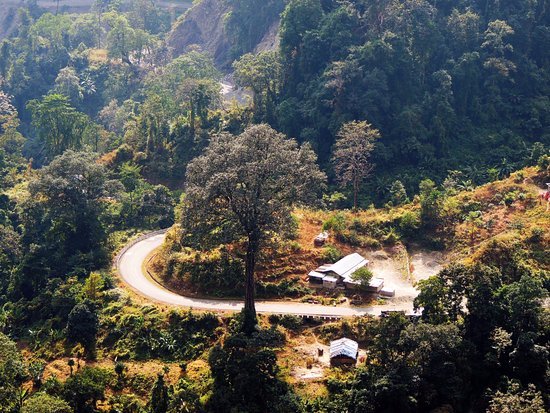
Driving from Guwahati to Tawang is one of northeast India’s most rewarding road journeys, threading through Assam’s plains into Arunachal Pradesh’s dramatic mountains. The route via Tezpur, Bomdila and Dirang offers manageable driving stages, scenic stops and acclimatisation that make the high-altitude reach to Tawang comfortable and memorable. This guide gives you practical, step-by-step advice on how to plan the trip, what to expect on the roads, essential permits and safety recommendations.
Overview: distance, duration and best time to travel
The Guwahati–Tawang route via Tezpur, Bomdila and Dirang covers roughly 500–550 km depending on the exact roads taken. Typical overland itineraries spread the journey over 4 to 6 days, allowing time for refreshment stops, sightseeing and altitude acclimatisation. Attempting the drive in fewer days is possible but not recommended because of the high mountain passes.
Best time to travel: Late April to mid-October is ideal. Summer and early autumn offer clear roads and open passes. Winters bring heavy snowfall at Sela Pass and frequent road closures; travel then requires local updates and suitable vehicles. Monsoon (June–September) can mean landslides and slippery roads—exercise caution and check local conditions.
Permits and paperwork
Arunachal Pradesh requires an Inner Line Permit (ILP) for most travellers. Get your ILP in advance online or at designated counters in Assam—Guwahati and Tezpur have offices that issue permits for Arunachal. Carry multiple printouts or mobile copies, ID proof and passport-size photographs if requested.
If you are hiring a vehicle, confirm the driver has valid permits to enter Arunachal. For self-drive, carry vehicle registration, insurance papers, Pollution Under Control (PUC) certificate and the driver's licence. Foreign nationals should additionally check visa stamps and any extra restrictions.
Recommended itinerary (4–6 days)
Below is a balanced itinerary that mixes driving days with acclimatisation and sightseeing. Distances and times are approximate and depend on traffic and road conditions.
Day 1: Guwahati to Tezpur
- Distance/time: around 175–200 km, roughly 4–6 hours.
- Highlights: drive along the Brahmaputra’s plains, Tezpur town and Agnigarh viewpoints, local snacks and tea stalls.
- Tip: Start early to avoid city traffic. Tezpur is a convenient first night stop with good hotels and eateries.
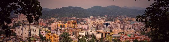
Day 2: Tezpur to Bomdila (via Bhalukpong/Bomdila road)
- Distance/time: about 170–220 km, 6–8+ hours depending on road conditions.
- Highlights en route: cross into Arunachal at Bhalukpong, visit Nameri National Park area if time allows, enjoy ascending scenery and riverside stops.
- Tip: This is a long day with winding mountain roads—carry water and snacks. Fuel up in Tezpur or Bhalukpong; petrol stations become sparse after Bhalukpong.
Day 3: Bomdila (rest and sightseeing)
- Reasons to stay: acclimatise to altitude (Bomdila is around 2,400 m), visit Bomdila Monastery and local apple orchards, explore viewpoints and local markets.
- Tip: Use this day for a relaxed pace; avoid heavy exertion and hydrate well.
Day 4: Bomdila to Dirang
- Distance/time: around 70–90 km, 3–4 hours depending on roads.
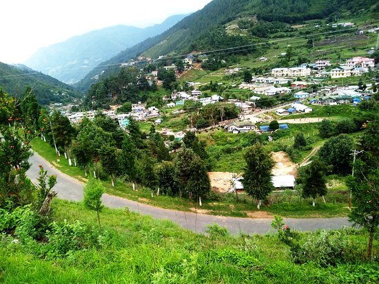
- Highlights: descend into scenic valleys, stop at roadside viewpoints and small villages; Dirang hot springs and medicinal plant nurseries are worth a visit.
- Tip: Dirang is a good acclimatisation stop before higher passes; accommodation ranges from guesthouses to mid-range hotels.
Day 5: Dirang to Tawang (via Sela Pass)
- Distance/time: approximately 160–180 km, 6–8 hours including stops.
- Key stops: the cliffside Jaswant Garh war memorial, Sangestar Tso (Madhuri Lake) if accessible, Sela Pass (altitude ~4,200 m) and scenic viewpoints before descending to Tawang.
- Tip: Start early to give time for stops and to avoid afternoon clouding. Sela Pass can be cold; carry warm layers even in summer.
Transport options
Private car/self-drive: Gives flexibility for stops and schedule. Many travellers hire SUVs or Tata Safari-style vehicles in Guwahati. Ensure the vehicle is well-maintained, with a spare tyre and toolkit. Seek local knowledge about road conditions before self-driving.
Shared cabs and taxis: Common between Guwahati–Tezpur and onwards; shared taxis for longer segments can be found at major towns. Negotiate fares and confirm whether the driver will proceed into Arunachal (permits and liability).
Local buses: Buses connect Guwahati to Tezpur and Tezpur to parts of Arunachal, but services are slower and less frequent. For flexibility on high-altitude legs and sightseeing stops, private vehicles are preferable.
Road conditions and driving tips
- Road types: Expect a mix of good national highways, single-lane mountain stretches, rough patches and occasional unpaved detours. Recent years have seen significant improvements, but conditions vary after rain or snow.
- Drive carefully: Mountain driving requires lower gears on ascents/descents, cautious overtakes and attention to blind turns. Use your horn on narrow corners as local drivers do, and be prepared for slow-moving trucks and military vehicles.
- Landslides and closures: Monsoon and winter can cause landslides or snow-blocked roads. Always check with locals, hotel staff or police for up-to-date status before a long day’s drive.
- Fuel: Fill tanks in major towns—Guwahati, Tezpur, Bhalukpong and Bomdila—because petrol pumps are sparse in higher reaches.
Health, altitude and safety
Sela Pass and surrounding areas rise above 4,000 metres. Acute Mountain Sickness (AMS) can affect anyone, so follow these measures:
- Acclimatise: Include an overnight stop at Bomdila and Dirang to allow gradual ascent.
- Hydrate and eat light: Keep fluids up and avoid alcohol during ascent.
- Recognise symptoms: Headache, nausea, fatigue and breathlessness require immediate descent and rest. Carry basic medications and consult a doctor if in doubt.
- Medical facilities: Primary healthcare centres exist in towns like Dirang and Bomdila; serious emergencies may require evacuation to larger hospitals in Tezpur or Guwahati.
Where to stay and eat
Tezpur: Wide range of hotels, guesthouses and restaurants. A good place to refresh before mountain roads.
Bomdila: Several mid-range hotels and guesthouses with views. Food options include local Arunachali dishes, Tibetan-influenced meals and basic Indian fare.
Dirang: Family-run hotels, homestays and guesthouses. Try local organic produce and simple mountain cuisine.
Tawang: Choices range from comfortable hotels to guesthouses. Book early in peak season. Food is a mix of Tibetan, local tribal and North Indian cuisine—momos, thukpa and rice-based dishes are common.
Sights and detours en route
- Nameri National Park (near Tezpur/Bhalukpong): Great for birding and river activities if you have time before heading up.
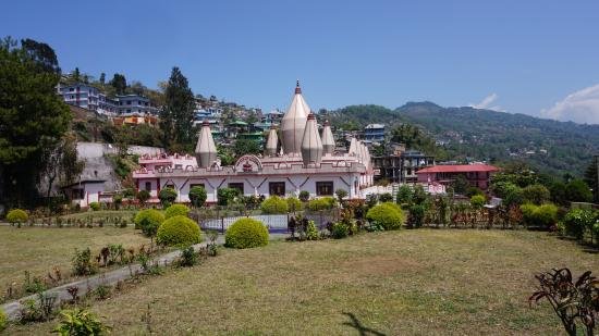
- Bomdila Monastery and viewpoints: Offers insight into local Monpa culture and panoramic vistas of the Eastern Himalaya.
- Dirang: Hot springs, monasteries and indigenous craft markets.
- Sangestar Tso (Madhuri Lake): A photogenic high-altitude lake near Tawang often included in day tours when road access is clear.
- Jaswant Garh: A poignant war memorial with historical significance and mountain views.
- Tawang Monastery: The major cultural highlight, one of the largest monasteries in India. Spend time exploring its complex, museums and nearby villages.
Packing checklist
- Warm layers, thermal innerwear and a windproof jacket (temperatures fall sharply at higher altitudes).
- Sun protection: sunglasses with UV protection, sunscreen and a hat.
- Basic first-aid kit, altitude sickness medication (after consulting a doctor), personal medications.
- Multiple ID copies, printed ILP, vehicle documents, power bank and offline maps.
- Snacks, water bottles and toiletries for long stretches with limited services.
Practical tips and local etiquette
- Respect local customs: Arunachal has diverse tribal communities—ask permission before photographing people or private property.
- Cash is useful: ATMs can be scarce in smaller towns; carry enough cash for fuel, permits and small purchases.
- Connectivity: Mobile networks are patchy in mountain stretches; download offline maps and share travel plans with someone at home.
- Support local businesses: Choose homestays, local guides and eateries when possible to support the regional economy.
Tip: Plan conservatively—good acclimatisation and flexibility for weather make the journey safer and far more enjoyable than a rushed schedule.
Final checklist before departure
- Check ILP status and vehicle documents.
- Vehicle maintenance: tyre check, spare tyre, coolant and engine oil top-up.
- Confirm accommodation bookings for Bomdila/Dirang and Tawang in peak season.
- Inform someone about your itinerary and expected check-in times.
Travelling from Guwahati to Tawang via Tezpur, Bomdila and Dirang is an unforgettable experience that balances cultural discovery with dramatic mountain scenery. With careful planning—respecting permits, taking time to acclimatise and staying flexible about weather—you’ll reach Tawang safely and with memories to last a lifetime.